Waterfalls Nearby

Waterfalls near Salem, Oregon

There are 76 named waterfalls within 50 miles of Salem, Oregon. The closest is Drift Creek Falls, about 15.5 miles away.

Updated November 2026. Distances are straight-line from the town center; the drive is longer.

Use my location instead

Best-known falls within 50 miles

The 40 closest named falls

  • Drift Creek Falls

    15.5 mi · Marion County · about 6.4 miles northeast of Sublimity

  • Lower South Falls

    17.9 mi · Marion County · about 92 ft · about 7.5 miles northeast of Sublimity

  • South Falls

    18.1 mi · Marion County · about 177 ft · about 7.3 miles north of Lyons

  • Frenchie Falls

    18.1 mi · Marion County · about 7.4 miles north of Lyons

  • Lower North Falls

    18.5 mi · Marion County · about 30 ft · about 8 miles north of Lyons

  • Echo Creek Falls

    18.6 mi · Marion County · about 4.3 miles south of Scotts Mills

  • Drake Falls

    18.6 mi · Marion County · about 26 ft · about 7.8 miles north of Lyons

  • Double Falls

    18.6 mi · Marion County · about 184 ft · about 8 miles north of Lyons

  • Middle North Falls

    18.7 mi · Marion County · about 105 ft · about 7.7 miles north of Lyons

  • Winter Falls

    18.9 mi · Marion County · about 135 ft · about 7.4 miles north of Lyons

  • Twin Falls

    19.1 mi · Marion County · about 30 ft · about 7.4 miles north of Lyons

  • North Falls

    19.8 mi · Marion County · about 135 ft · about 7.3 miles north of Lyons

  • Upper North Falls

    20.2 mi · Marion County · about 66 ft · about 7.2 miles north of Lyons

  • Shellburg Falls

    21.7 mi · Marion County · about 2.3 miles north of Lyons

  • Lower Shellburg Falls

    21.8 mi · Marion County · about 2.1 miles north of Lyons

  • Stasel Falls

    22.2 mi · Marion County · about 2.1 miles north of Lyons

  • Abiqua Falls

    22.3 mi · Marion County · about 92 ft · about 9.3 miles southeast of Scotts Mills

  • Berry Creek Falls

    22.4 mi · Polk County · about 1.7 miles west of Falls City

  • Ayers Creek Falls

    22.6 mi · Marion County · about 2.5 miles northeast of Lyons

  • Upper Abiqua Falls

    22.7 mi · Marion County · about 9.8 miles southeast of Scotts Mills

  • Horseshoe Falls

    22.8 mi · Marion County · about 2.5 miles northeast of Lyons

  • Stout Creek Falls

    23.3 mi · Marion County · about 3 miles northeast of Lyons

  • Fall Creek Falls

    23.8 mi · Clackamas County · about 8.1 miles southeast of Scotts Mills

  • Lower Butte Creek Falls

    25 mi · Clackamas County · about 11 miles northeast of Lyons

  • Butte Creek Falls

    25 mi · Marion County · about 79 ft · about 11 miles northeast of Lyons

  • Upper Butte Creek Falls

    25 mi · Clackamas County · about 26 ft · about 11 miles northeast of Lyons

  • Silver Falls

    27.5 mi · Polk County · about 7.7 miles west of Falls City

  • Baker Creek Falls

    28 mi · Yamhill County · about 8.2 miles northwest of McMinnville

  • Salmon Falls

    32.6 mi · Marion County · about 5.8 miles northeast of Gates

  • Henline Falls

    33.9 mi · Marion County · about 7.5 miles northeast of Gates

  • Valsetz Falls

    35.1 mi · Lincoln County · about 13 miles northeast of Siletz

  • Coffee Creek Falls

    35.1 mi · Clackamas County · in Oregon City

  • Niagara Falls

    35.4 mi · Yamhill County · about 135 ft · about 9.2 miles north of Grand Ronde

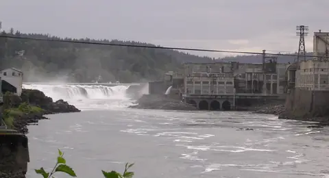
  • Willamette Falls

    35.5 mi · Clackamas County · about 39 ft · in Oregon City

  • Pheasant Creek Falls

    35.5 mi · Yamhill County · about 125 ft · about 9.2 miles north of Grand Ronde

  • Tumble Creek Falls

    35.5 mi · Clackamas County · in Oregon City

  • Nenamusa Falls

    35.6 mi · Tillamook County · about 13 miles northwest of Willamina

  • Majestic Falls

    35.8 mi · Linn County · about 4.6 miles north of Sweet Home

  • Royal Terrace Falls

    36 mi · Linn County · about 4.2 miles north of Sweet Home

  • Singer Falls

    36.2 mi · Clackamas County · in Oregon City

36 more named falls are within 50 miles. The county lists below include them.