Waterfalls Nearby

Waterfalls in Oconee County, South Carolina

Oconee County, South Carolina has 82 named waterfalls in our directory. The nearest towns for most of them are Longcreek, Tamassee and Salem. The tallest recorded height is King Creek Falls, at about 66 feet.

Updated November 2026

82Named falls

3With a recorded height

4With their own page

Best-documented falls in Oconee County
All named falls in Oconee County

Falls with a linked name have their own page. The rest have too little recorded detail for a page of their own, so they are listed here with height, nearest town and a directions link.

  • Blue Hole Falls

    about 8 ft · about 4.1 miles east of Longcreek

  • Isaqueena Falls

    about 4.5 miles northwest of Walhalla

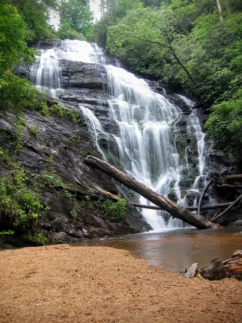
  • King Creek Falls

    about 66 ft · about 9.4 miles northwest of Salem

  • Riley Moore Falls

    about 12 ft · about 5.3 miles southeast of Longcreek

  • Andrew Ramey Falls

    about 2.7 miles north of Longcreek

  • Bad Creek Falls

    about 6 miles north of Salem

  • Battle Creek Falls

    about 6.9 miles southwest of Longcreek

  • Bee Cove Falls

    about 7.4 miles northwest of Salem

  • Bone Camp Creek Falls

    about 4.7 miles east of Longcreek

  • Boyer Falls

    about 7.1 miles southwest of Longcreek

  • Brasstown Falls

    about 5.3 miles southwest of Longcreek

  • Camp Branch Falls

    about 3.3 miles southwest of Longcreek

  • Cedar Creek Falls

    about 4.1 miles east of Longcreek

  • Chau Ram Falls

    about 3.3 miles west of Westminster

  • Chauga Narrows

    about 5.6 miles northeast of Longcreek

  • Cheohee Road Falls

    about 5.8 miles northwest of Tamassee

  • Crane Creek Falls

    about 5.4 miles northwest of Tamassee

  • Crane Falls

    about 5 miles northwest of Tamassee

  • Crossland Creek Falls

    about 4.6 miles northwest of Tamassee

  • Deadfall Falls

    about 5.5 miles northwest of Tamassee

  • Disappearing Falls

    about 4.6 miles west of Tamassee

  • Double Branch Falls

    about 1.8 miles east of Longcreek

  • Double Spring Mountain Falls

    about 7.5 miles north of Salem

  • Fall Creek Falls

    about 2.5 miles north of Longcreek

  • Fall Creek Falls

    about 3.5 miles east of Salem

  • Final Falls

    about 2.6 miles north of Longcreek

  • Hidden Falls

    about 4.3 miles west of Tamassee

  • High Falls

    in Keowee Key

  • Hiker's Peril Falls

    about 8.8 miles northwest of Salem

  • Homer's Falls

    about 3.7 miles west of Longcreek

  • Horse Bone Falls

    about 4.4 miles west of Tamassee

  • Horsehead Point Falls

    about 3.6 miles northwest of Clemson

  • Ira Branch Falls

    about 7.9 miles west of Tamassee

  • Jim Lee Falls

    about 5.7 miles northwest of Walhalla

  • John Danner Falls

    about 3.8 miles southwest of Longcreek

  • Kings Creek Falls

    about 9.4 miles northwest of Salem

  • Land Bridge Falls

    about 7.5 miles northwest of Walhalla

  • Lee Falls

    about 5.1 miles west of Tamassee

  • Licklog Falls

    about 7.5 miles northwest of Tamassee

  • Limestone Falls

    about 5 miles northeast of Longcreek

  • Little Brasstown Falls

    about 5.3 miles southwest of Longcreek

  • Little Fall Creek Falls

    about 2.4 miles north of Longcreek

  • Little Miuka Falls

    about 5.3 miles northwest of Tamassee

  • Lohr's Falls

    about 5 miles northwest of Walhalla

  • Long Creek Falls

    about 3.8 miles west of Longcreek

  • Longnose Creek Falls

    about 9.4 miles west of Westminster

  • Lower Falls

    about 8.9 miles north of Salem

  • Lower Miuka Falls

    about 5.4 miles northwest of Tamassee

  • Lower Sloan Bridge Falls

    about 8.9 miles northwest of Salem

  • Lower Wash Branch Falls

    about 5.3 miles northwest of Tamassee

  • Lower Whitewater Falls

    about 8.9 miles north of Salem

  • Maxie Duke Falls

    about 3.6 miles southwest of Longcreek

  • Middle Long Creek Falls

    about 2.1 miles west of Longcreek

  • Midway Falls

    about 2.7 miles north of Longcreek

  • Mill Creek Falls

    about 11 miles north of Salem

  • Miuka Falls

    about 5.5 miles northwest of Tamassee

  • Norm's Falls

    about 2.7 miles northwest of Longcreek

  • Opossum Creek Falls

    about 3.8 miles southwest of Longcreek

  • Pigpen Falls

    about 7.3 miles northwest of Tamassee

  • Pollock Falls

    about 4.6 miles northwest of Walhalla

  • Pristine Falls

    about 2.6 miles north of Longcreek

  • Prospector Falls

    about 5.5 miles northwest of Tamassee

  • Reedy Branch Falls

    about 2 miles northwest of Longcreek

  • Rhodo Falls

    about 2.7 miles north of Longcreek

  • Secret Falls

    about 5.2 miles northwest of Tamassee

  • Shoulder Bone Falls

    about 3.3 miles southwest of Longcreek

  • Side Pocket Falls

    about 2.5 miles north of Longcreek

  • Sids Falls

    about 3.5 miles southwest of Longcreek

  • Slatten Branch Falls

    about 9.2 miles northwest of Salem

  • Snider Falls

    about 8.2 miles northeast of Longcreek

  • Sparkle Falls

    about 3.6 miles southwest of Longcreek

  • Spoonauger Falls

    about 9.7 miles northwest of Salem

  • Station Cove Falls

    about 5.8 miles north of Walhalla

  • Triple Falls

    about 2 miles north of Longcreek

  • Upper Long Creek Falls

    about 2 miles west of Longcreek

  • Upper Opossum Creek Falls

    about 3.8 miles southwest of Longcreek

  • Upper Pigpen Falls

    about 7.3 miles northwest of Tamassee

  • Upper Sloan Bridge Falls

    about 9 miles northwest of Salem

  • Upper Wash Branch Falls

    about 5.4 miles northwest of Tamassee

  • Wright Creek Falls

    about 8.3 miles north of Salem

  • Yellow Branch Falls

    about 4.8 miles west of Walhalla

  • Yellow Jacket Falls

    about 5.4 miles northwest of Tamassee