Waterfalls Nearby

Waterfalls near Helen, Georgia

There are 63 named waterfalls within 25 miles of Helen, Georgia, across 3 states. The closest is Alana Falls, about 0.5 miles away, and 11 falls are within 10 miles.

Updated November 2026. Distances are straight-line from the town center; the drive is longer.

Use my location instead

Best-known falls within 25 miles

The 40 closest named falls

  • Alana Falls

    0.5 mi · White County · in Helen

  • Dukes Creek Falls

    3.6 mi · White County · about 3.6 miles west of Helen

  • Duke Creek Falls

    3.7 mi · White County · about 3.7 miles west of Helen

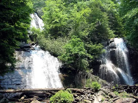
  • Anna Ruby Falls

    4 mi · White County · about 4 miles north of Helen

  • Raven Cliff Falls

    5.6 mi · White County · about 5.6 miles west of Helen

  • Horse Trough Falls

    6.7 mi · Union County · about 6.7 miles northwest of Helen

  • Lower Sorrels Branch Falls

    8.9 mi · Towns County · about 7.6 miles south of Hiawassee

  • Upper Sorrels Branch Falls

    8.9 mi · Towns County · about 7.6 miles south of Hiawassee

  • Lower Garrett Branch Falls

    9.4 mi · Towns County · about 7.4 miles south of Hiawassee

  • Upper Garrett Branch Falls

    9.4 mi · Towns County · about 7.4 miles south of Hiawassee

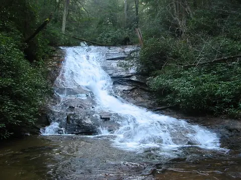
  • Helton Creek Falls

    10 mi · Union County · about 9.1 miles south of Blairsville

  • Wilson Falls

    10.7 mi · Habersham County · about 9.4 miles west of Tiger

  • Upper DeSoto Falls

    10.7 mi · Lumpkin County · about 11 miles west of Helen

  • Lower DeSoto Falls

    10.8 mi · Lumpkin County · about 11 miles west of Helen

  • High Water Falls

    11 mi · Lumpkin County · about 11 miles south of Blairsville

  • DeSoto Falls, Georgia

    11 mi · Lumpkin County · about 11 miles west of Helen

  • Nottely Falls

    11.2 mi · Union County · about 9.3 miles south of Blairsville

  • Hemlock Falls, Rabun County

    12 mi · Rabun County · about 10 miles southeast of Hiawassee

  • Dicks Creek Falls

    12.1 mi · Lumpkin County · about 11 miles north of Dahlonega

  • Blood Mountain Creek Falls

    12.4 mi · Lumpkin County · about 9.7 miles south of Blairsville

  • Minnehaha Falls, Georgia

    14.3 mi · Rabun County · about 5.5 miles west of Tallulah Falls

  • Haynes Falls

    14.8 mi · Towns County · about 2.3 miles south of Young Harris

  • Walden Creek Waterfall

    17.2 mi · Lumpkin County · about 8.5 miles north of Dahlonega

  • Upper Canada Creek Falls

    17.3 mi · Union County · about 11 miles north of Dahlonega

  • Stonewall Falls

    17.6 mi · Rabun County · about 2 miles southwest of Tiger

  • Lower Canada Creek Falls

    18 mi · Union County · about 12 miles north of Dahlonega

  • Timpson Falls

    18.5 mi · Rabun County · about 4.1 miles northwest of Tiger

  • L'Eau d'Or Falls

    19.1 mi · Rabun County · in Tallulah Falls

  • Tempesta Falls

    19.1 mi · Rabun County · in Tallulah Falls

  • Hurricane Falls

    19.2 mi · Rabun County · in Tallulah Falls

  • Oceana Falls

    19.4 mi · Rabun County · in Tallulah Falls

  • Cascade Falls

    19.4 mi · Rabun County · in Tallulah Falls

  • Caledonia Cascade

    19.4 mi · Rabun County · about 1.3 miles north of Tallulah Falls

  • Panther Creek Falls

    19.4 mi · Habersham County · about 131 ft · about 3.4 miles south of Tallulah Falls

  • Bridal Veil Falls

    19.5 mi · Habersham County · in Tallulah Falls

  • Clay Creek Falls

    20.5 mi · Lumpkin County · about 2.5 miles west of Dahlonega

  • Stekoa Falls

    20.7 mi · Rabun County · about 2 miles east of Tiger

  • Sea Creek Falls

    21.3 mi · Fannin County · about 11 miles southwest of Blairsville

  • Battle Creek Falls

    22 mi · Oconee County · South Carolina · about 6.9 miles southwest of Longcreek

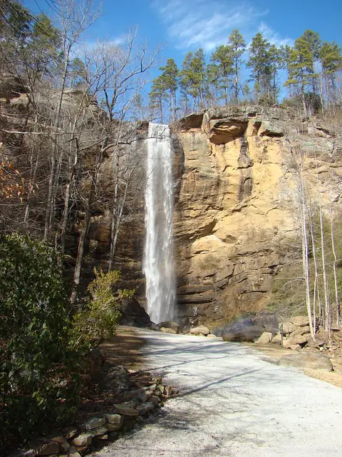
  • Toccoa Falls

    22.3 mi · Stephens County · about 186 ft · about 2.1 miles northwest of Toccoa

23 more named falls are within 25 miles. The county lists below include them.